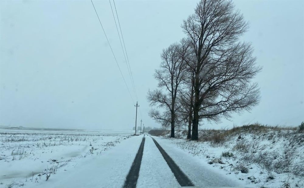
Several warnings have been issued for Saturday, including for disruptive snow, rain, and strong winds across various provinces. (Derick van Zyl/Supplied)
The South African Weather Service has issued several warnings for Saturday, including disruptive snow, rain, and strong winds across various provinces. Communities may face cut-offs, service disruptions, and hazardous driving conditions.
Impact-based warnings
- Orange Level 6 Warning for disruptive snow: Communities may be cut off, services disrupted, and vulnerable livestock and crops lost in the north-eastern parts of the Free State, extreme south-western parts of KwaZulu-Natal, and the extreme north-eastern parts of the Eastern Cape.
- Yellow Level 2 Warning for disruptive snow: Isolated losses of vulnerable livestock and crops, non-major passes closed for short periods, and some traffic disruptions in the southern and eastern parts of the Free State, northern interior of the Eastern Cape, western and south-western parts of KwaZulu-Natal, and the southern Highveld of Mpumalanga.
- Yellow Level 2 Warning for disruptive rain: Localised flooding of susceptible formal and informal settlements and roads, as well as difficult driving conditions, expected over parts of KwaZulu-Natal except the extreme north-eastern and southern parts.
- Yellow Level 2 Warning for winds: Problems for high-sided vehicles on prone routes expected over the western interior of the Northern Cape.
Advisories
A cut-off low pressure system is expected to affect the eastern parts of the Eastern Cape, KwaZulu-Natal, parts of the Free State, Mpumalanga, and Gauteng. The public and small stock farmers are advised of the following:
Very cold conditions (maximum temperatures below 10°C) expected over the north-eastern interior of the Eastern Cape, interior of KwaZulu-Natal, eastern parts of the Free State, Highveld and escarpment of Mpumalanga, and places in Gauteng.
Snowfalls expected over the southern and eastern high ground of the Free State including the Lesotho border, eastern high ground of the Eastern Cape, western and southern high ground of KwaZulu-Natal, and southern Highveld and escarpment of Mpumalanga.
The weather in your region
Gauteng: Cloudy and cold to very cold with light rain at times.
- Pretoria 7°C — 11°C
- Johannesburg 5°C — 9°C
- Vereeniging 5°C — 8°C
Mpumalanga: Cloudy and cold to very cold with scattered showers and thundershowers, but isolated showers in the west. Snow is possible along the escarpment and southern Highveld.
- Mbombela 8°C — 10°C
- Ermelo 1°C — 4°C
- Emalahleni 6°C — 9°C
- Standerton 3°C — 6°C
- Skukuza 13°C — 16°C
Limpopo: Cloudy and cold with isolated showers, but scattered along the escarpment.
- Polokwane 5°C — 14°C
- Phalaborwa 9°C — 15°C
- Tzaneen 6°C — 11°C
- Musina 9°C — 16°C
- Lephalale 11°C — 20°C
- Mokopane 8°C — 21°C
North West: Cloudy, windy, and cold with isolated light showers, except in the extreme north-west.
- Klerksdorp 6°C — 11°C
- Potchefstroom 5°C — 10°C
- Mahikeng 9°C — 17°C
- Rustenburg 10°C — 14°C
- Vryburg 5°C — 17°C
Free State: Cloudy, windy, and cold to very cold with isolated to scattered showers. Snow is possible over the eastern and southern parts and along the Lesotho border.
- Bloemfontein 2°C — 12°C
- Welkom 3°C — 10°C
- Bethlehem 0°C — 5°C
Northern Cape: Partly cloudy in the east but cloudy in the extreme east with isolated light showers where it will be cold, otherwise fine, windy, and cool but warm in the west.
Coastal wind – fresh to strong south-easterly.
- Upington 6°C — 23°C
- Kimberley 3°C — 15°C
- De Aar 3°C — 18°C
- Alexander Bay 13°C — 32°C
- Springbok 11°C — 22°C
- Calvinia 7°C — 23°C
- Sutherland -1°C — 15°C
Western Cape: Partly cloudy over the north-eastern interior in the morning, otherwise fine and cool to warm.
Coastal wind – strong easterly to south-easterly.
- Cape Town 12°C — 22°C
- Vredendal 14°C — 28°C
- Riversdale 6°C — 22°C
- George 18°C — 17°C
- Worcester 5°C — 22°C
- Beaufort West 5°C — 19°C
- Oudtshoorn 5°C — 23°C
Eastern Cape: Cloudy and cool, but cold in places north-east, becoming partly cloudy in the afternoon.
Coastal wind – moderate to fresh south-easterly.
The eastern half of the province will be very cold in places over the interior, otherwise cloudy and cold with isolated showers and rain, but scattered in the east and along the Wild Coast. Snow is expected over high-lying areas.
Coastal wind – moderate to fresh north-easterly.
- Gqeberha 10°C — 20°C
- Makhanda 6°C — 17°C
- Cradock 4°C — 17°C
- Graaff-Reinet 3°C — 19°C
- East London 10°C — 18°C
- Port St Johns 11°C — 19°C
- Umtata 7°C — 13°C
- Komani 3°C — 12°C
- Qonce 6°C — 16°C
KwaZulu-Natal: Cloudy and cold to very cold with widespread showers and rain, but scattered in the south. Snow is expected over the western and south-western parts.
Coastal wind – light and variable, becoming moderate to fresh easterly to south-easterly from the morning.
- Durban 11°C — 15°C
- Richard’s Bay 12°C — 16°C
- Pietermaritzburg 8°C — 12°C
- Ladysmith 0°C — 7°C
*This weather report was written with the support of Toqan AI.