Prepare for disruptive snow, rain and high winds, which will cause service disruptions, icy roads and navigation difficulties at sea.
Extremely high fire danger and hot conditions are expected in parts of the North West and Limpopo, with very cold temperatures and snowfalls affecting several regions, according to the South African Weather Service.
Impact-based warnings
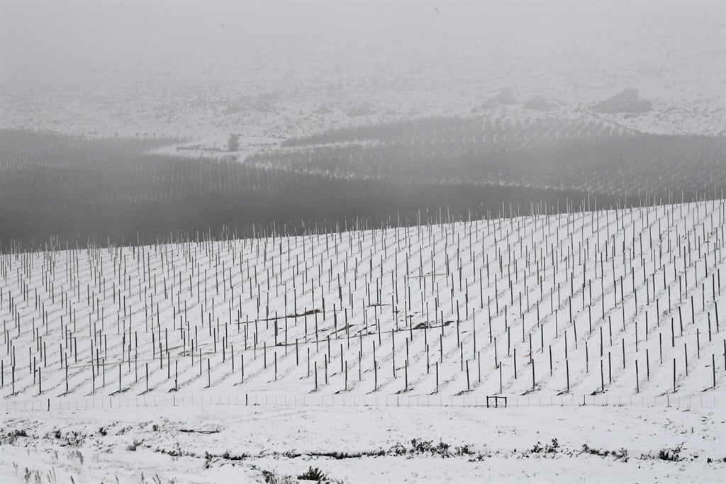
Disruptive snow is expected over the north-eastern high-ground of the Eastern Cape, leading to service disruptions and temporary community cut-offs.
Wind and waves will cause navigation difficulties at sea and localised disruptions to harbours or ports between Saldanha Bay and Maputo.
Disruptive rain, which will lead to localised flooding in the Garden Route of the Western Cape.
Disruptive snow, which will cause icy roads and temporary closure of mountain passes in the northern and central high-ground of the Eastern Cape.
Wind will cause navigation difficulties at sea between Saldanha Bay and Alexander Bay.
Fire danger warning
Extremely high fire danger conditions are expected over the north-western and north-eastern parts of North West.
Advisories
Extremely hot conditions are expected over the north-eastern parts of Limpopo.
A cut-off low-pressure system will affect the Eastern Cape, KwaZulu-Natal, parts of the Free State, Mpumalanga and Gauteng from Friday into Saturday.
The public and small stock farmers are advised of the following:
– Very cold conditions (maximum temperatures below 10°C) are expected over the interior of the Eastern Cape, KwaZulu-Natal, southern and eastern Free State, and the Highveld and escarpment of Mpumalanga from Friday into Saturday, spreading to Gauteng on Saturday.
– Snowfalls are expected over the southern and eastern high-ground of the Free State, the eastern and northern high-ground of the Eastern Cape, the western and southern high-ground of KwaZulu-Natal, and the southern Highveld and escarpment of Mpumalanga on Friday into Saturday morning.
Provincial weather updates
Gauteng: Fine and warm, but hot in the extreme north.
- Johannesburg 10°C — 27°C
- Vereeniging 9°C — 27°C
Mpumalanga: Fine and warm, but very hot in the Lowveld.
It will become cloudy over the eastern parts in the evening, with drizzle along the escarpment.
- Emalahleni 12°C — 29°C
- Standerton 9°C — 27°C
- Skukuza 15°C — 34°C
Limpopo: Fine and hot to very hot, but extremely hot in the north-east.
It will become partly cloudy in the south-eastern parts in the evening.
- Polokwane 16°C — 33°C
- Phalaborwa 17°C — 39°C
- Lephalale 14°C — 36°C
- Mokopane 16°C — 34°C
North West: Fine and warm to hot.
- Klerksdorp 8°C — 29°C
- Potchefstroom 8°C — 29°C
- Rustenburg 13°C — 34°C
Free State: Fine and cool to warm, but partly cloudy in the south-west, where it will be windy and cold.
- Bloemfontein 6°C — 21°C
- Bethlehem 6°C — 23°C
Northern Cape: Fine, windy and cool, but partly cloudy to cloudy and cold in the south.
The wind along the coast will be fresh to strong southerly to south-easterly, reaching near-gale force from late afternoon.
- Alexander Bay 10°C — 19°C
- Sutherland 1°C — 11°C
Western Cape: Partly cloudy in the west, otherwise cloudy and cold, with isolated showers and rain, except over the north-western parts, where it will be cool.
Scattered to widespread showers and thundershowers are expected along the south coast and adjacent interior.
Light snow is possible over the eastern mountains from the evening.
The wind along the coast will be fresh to strong southerly to south-easterly, becoming easterly along the south coast from late evening.
- Cape Town 11°C — 16°C
- Riversdale 11°C — 15°C
- Beaufort West 8°C — 15°C
- Oudtshoorn 9°C — 13°C
Eastern Cape: Cloudy and cold, with scattered showers and rain in the western half of the Eastern Cape, but widespread in the south.
Snow is expected over the high-lying areas.
The wind along the coast will be fresh to strong south-westerly early morning, otherwise moderate to fresh south-easterly, reaching strong in places.
It will be cloudy and cold, with isolated to scattered showers and rain in the eastern half of the Eastern Cape, but widespread along the coast and adjacent interior.
It will be very cold in places over the high-lying areas, where snow is expected from the afternoon.
The wind along the coast will be moderate to fresh south-westerly, reaching strong in places.
It will become fresh to strong south-easterly in the afternoon.
- Graaff-Reinet 5°C — 12°C
- East London 12°C — 16°C
- Port St Johns 14°C — 19°C
KwaZulu-Natal: Fine in the west in the morning, otherwise cloudy and cool to warm, with isolated showers and rain, but scattered in the extreme south.
The wind along the coast will be moderate to fresh southerly to south-westerly, becoming strong to near-gale in the afternoon.
- Richard’s Bay 17°C — 22°C
- Pietermaritzburg 12°C — 16°C
- Ladysmith 7°C — 24°C